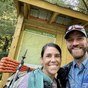
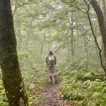
“What is that?” The words posed one question while simultaneously answering another, namely, “are you sure you’re prepared?” That was 5 days ago now while Ace and I were in the midst of finishing her 13-year quest to become an Adirondack 46er. But the question still makes me cringe a little.
Search Results for: woods
Woodstock Stage Road
Nice terrain, lots of PUDs. Not much more to say about that. Footloose and the Camera Crew and I popped in to the tiny "town" of South Pomfret to grab dinner, snacks, ice cream and beer at the general store. We had some great chatter over dinner across from the store before deciding to stealth camp on the porch of the Suicide Six ski area just up the street.
The Second Time Around
As with most evenings on this trail, I am cozy in my hammock before 8:00pm. Sweet Pea would be proud. This is the second time I’m doing this hike (the first time was in 2015). And with each passing mile, I can’t help but think how little has changed and how much has changed, all at the same time.
The Residentially Challenged Life
Ever since June 2020, when Mountain Man and I embarked on our hike of the Continental Divide Trail (CDT) we have been what some may call “location independent,” “nomadic”, “wanderers”, or even “homeless.”
We prefer to call ourselves “residentially challenged.”
Mogollon Rim
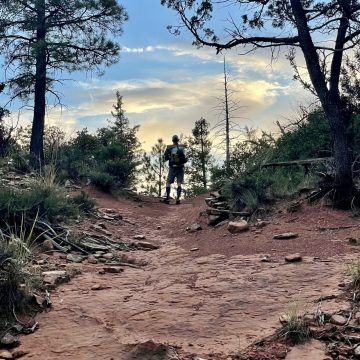
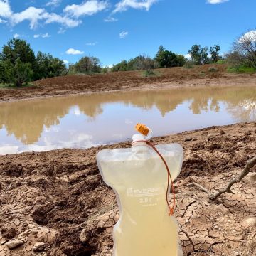
The morning discovered us in a state now quite familiar: strolling past a shallow depression full of dark brown water. Fine crystals of frost on nearby meadow grasses sparkled in the first rays of sunlight, while those that had been warmed for but a few minutes had already melted into droplets that now weighed heavily on the blades to which they clung.
Pavlovian
My feet seem to know where they need to go. Limbs move, trekking poles find their next position with a gentle clack against the rock, quads laden with lactic acid somehow swing each leg forward only to have the process repeat itself nearly 50,000 more times.
Surprise!
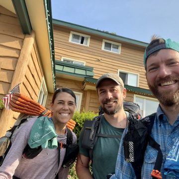
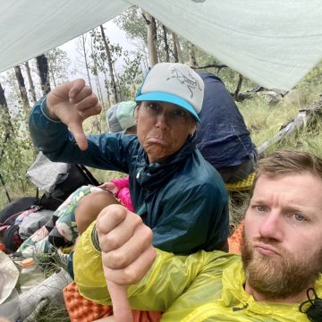
Surprise! Apparently the temptation of dragging oneself through mud and over rocks for a few days was too hard to resist for at least one person. Well, now you’ll know the face of the person who was just crazy enough to come and join us for the next 60 miles of that kind of fun: our friend Jesse Surprise.
Where Did Everybody Go?
I smelled my shirt just as a quick check. Yup, I smell terrible. But surely that can’t be the answer, can it? The reason for my olfactory investigation wasn’t because I was unsure of exactly how awful I stunk—I was already quite certain of that. It was because I couldn’t find an explanation to why we so suddenly had the trail all to ourselves.
Green Mountain Rainforest
Hearing the patter of raindrops on the roof of the tent, it was hard to know whether last night’s storm had overstayed its welcome or if the winds that had swept it away were simply ushering downward the moisture that had collected on the canopy above us. By the time we realized it was the latter, it was on to a familiar routine.
A Trail Runs Through It
By the time we'd laid our heads to rest last night, the official CDT was miles away. Turning away from the Black Range, we'd opted instead for an alternate that would take us along the course of the Gila River and today would grant us our first glimpse of it.
Priorities
I wonder about the world. Not the world of nature we've had the luxury of escaping to these past 4 months, the other one. The one hikers semi-jokingly refer to as the “artificial world.” Detachment from the cares and strictures of that world is a feature of thru-hiking, not a bug, but roiled by a pandemic, that detachment has grown exponentially.
The Upside Down Place
If you have any fondness for the ‘80s, the Netflix series Stranger Things and its sinister “Upside Down Place” has probably made your watchlist (and if it hasn't yet, it should). But there's another “Upside Down Place” of a less supernatural sort too—and we've been walking through it all day.
Where Water Goes to Die
One truck. Then another. And another, and another. On and on went the 4am procession, racing past our tent that wasn't 20 feet from the shoulder of the highway we'd followed since leaving Rawlins yesterday. Hunting season had apparently followed us all the way from north of the Wind River Range to here, where midnight had marked the beginning of the local rifle season.
Welcome to the Dining Room
We don't give them much thought, but they sure are everywhere. Roads. Dirt ones, paved ones, gravel ones, long-since abandoned logging ones, and every other flavor of the road rainbow. Walking long distances gives you a new appreciation of just how extensive the totality of our road system really is…
500 and Counting
It sounds like a reasonably long distance when I say it out loud. I can't even tell you two cities that are roughly 500 miles apart, but if I could my next suggestion would certainly not be to walk from one to the other. That's what planes are for.
The Good Old Days
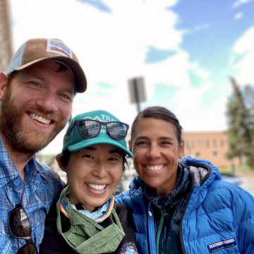
Right on schedule, 45 minutes early. That's our friend Hoa, having changed her uber-punctual habits not at all in the years since she had left Seattle and relocated outside of Denver. Appearing from the woods for our rendezvous at 7am as we were, she was striding across the parking lot having driven all the way out to meet us for the morning. Marathoner, ultra runner, ultra human. That's Hoa.
Winter Park

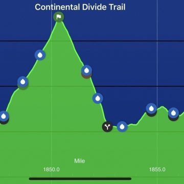
When short days like this dawn, it's hard to think about much else than the shower and town food waiting at the end of the rainbow. But standing between us and that promised land was another 13,000 foot summit and a perfect morning to climb up and over it.
Rookie Perspective #2: The CDT Back Flip, with a Twist
As I said in my previous guest post, I’m a rookie. What do I know? However, as we began planning for the CDT I quickly learned that conditions must be perfect (said to the tune of Flight of the Conchords, of course) in order to hike this big ass trail continuously and without performing any mental, logistical or geographical gymnastics.
Mmm, That Looks Delicious
The rain that had rocked us to sleep was now a distant memory, the moisture on the lowland grasses and the faintly muddy trail the only reminders that it had even been there at all. The morning began with some brief x-country walking followed by a climb up a rough herd path that eventually delivered us back to the top of the Rim.
Country Roads, Take Me Home
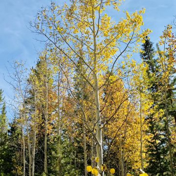
From a distance, the mountains are beginning to show the early signs of autumn. Mixed amid the pervasive evergreens, the leaves of the huckleberry bushes are now mostly bright red with the occasional tinge of yellow, giving the forest a prototypical pop of fall color. Not only that, but each time we think we've seen the last of the berries, we're proven wrong yet again.
Washington, My Home
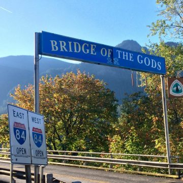
On the last day of August, we'd finally reached the last state of the trail, my now-home state of Washington. At only about 100 feet above sea level, the Bridge of the Gods that spans the Columbia River linking Oregon to Washington is the lowest elevation on the entire trail. For fans of the book Wild, it is also the place where Cheryl Strayed's adventure on the PCT came to a close.
Sins of the Virgin Voyage
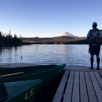
Early this morning, just before leaving Olallie Lake I stepped out onto the dock to enjoy the view over the lake to Mount Jefferson bathed in the early light of the day. There wasn't a soul stirring anywhere and the lake was glassy with calm. I can't think of a better way to start a day.
Land of Lakes
The terrain today was something quite different from anything we'd seen on the trail so far. Like the deep woods of Maine, it was lake after lake after lake of varying sizes all day, with many separated by no more than a tenth of a mile or two. Perhaps not surprisingly, with the advent of so much standing water, swarms of mosquitoes were not far behind.
Welcome to Oregon
The sound of the morning was an unusual one: a distant chime and then a cluster of them, faint but clear. High on a ridge near 7,000 feet, the list of possible sources was quite limited. As it grew louder, the chimes revealed themselves for what they really were: cow bells. The patchwork of meadows we'd seen since yesterday were the perfect place for a herd of free-ranging cattle to graze.
Coppertone Strikes Again
Some days everything seems to go right, and this was one of those days. Yesterday's good fortune of spending the night at Nancy & Terry's cabin in the woods was perhaps the most relaxing and satisfying surprise of the entire trail thus far and the trend only continued this morning when we were greeted with coffee, pancakes, bacon and eggs for breakfast.
Zero #7
Whenever I'm cramming in the usual town chores that invariably consume a surprisingly large amount of a day off, it's a brief opportunity that grants just enough physical and mental distance from the trail itself to reflect on this journey as it unfolds. Beneath the beauty that lives on the surface of nearly every footstep, my mind sometimes stumbles upon even more fulfilling ways of seeing into the prism of the trail experience.
Water Water Everywhere
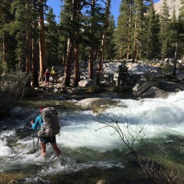
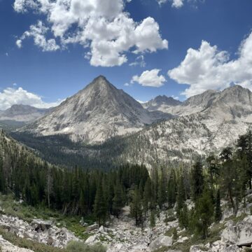
Today was a very simple story of one thing, a simultaneous protagonist and antagonist: water. On the one hand, its beauty and abundance are part of what make the Sierra such a pleasure to hike through. On the other, the spring snowmelt has swollen even seasonal streams into bone chillingly cold shin-deep fords.
John Muir Trail 2015

An image gallery of photos from the John Muir Trail—the jewel of the High Sierra, running 210-miles from Mt. Whitney to Yosemite Valley. Start Point: Yosemite Valley, CAEnd Point: Mt. Whitney, CATotal Length: 211 miles
Wonderland Trail 2006

An image gallery of photos from the Wonderland Trail, a 91-mile footpath circumnavigating Mount Rainier within Mount Rainier National Park. Start Point: Longmire, WAEnd Point: Longmire, WATotal Length: 93 miles
Rainbow Stream

After a massive group breakfast that featured all-you-can-eat blueberry pancakes, our merry band of thru-hikers loaded into the boat for a ride back across the lake and back to our default task of hiking north. Not 2 hours into the day, we came across a random woods road near the shore of a lake where a picnic tent had been setup to host trail magic…
Franconia Notch
Today was a day that got shorter and shorter as the weather got worse. Waldo caught up with Footloose, Walk On, and I after our morning chores at the hut and we all hiked the couple easy miles to Franconia Notch where we hitched in to North Woodstock for a resupply.
Happy Hill
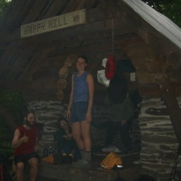
Some beautiful views from some low hills today, but I'm really just getting psyched up for New Hampshire! Took a nice nap in West Hartford on a bench near the White River after some Ben & Jerry's ice cream with Footloose and the Camera Crew. Today's definite highlight was a very unexpected late arrival by my old friend Camel, who I haven't seen since Atkins, VA several months ago.
Roaring Fork
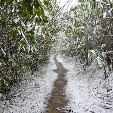
Well, it was bound to happen eventually. Celebrated my third-week trail anniversary today as our good weather came to a screeching halt as 70-degree sunshine was now a steady day-long snowstorm. And, yes, for those of you back home up north, this is still North Carolina.